
 Алгебра
 Английский
 Биология
 География
 Геометрия
 История
 Русский
 Обществознание
 Физика
 Химия
Химия Информатика
 Литература
 Математика
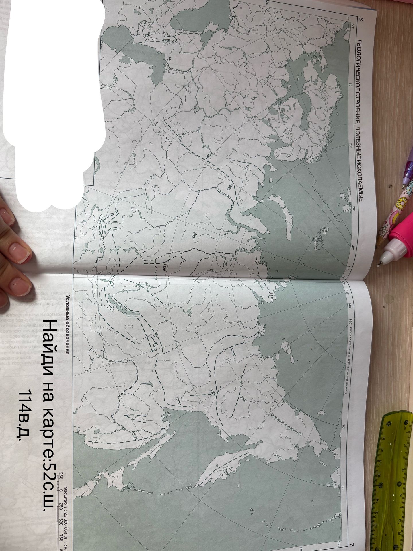
Find the symbols on the map: 52° N latitude. 114° E longitude.
Ответ:
Finding symbols on the map:
To find the symbols on the map for 52° N latitude and 114° E longitude, locate the intersection of these two lines on the map. The map shows various geographical features and potentially some data points or regions marked by dashed lines and numbers. Without specific symbols or a legend provided in the image for these exact coordinates, it is impossible to identify a specific symbol or feature directly associated with 52° N and 114° E. The numbers on the map likely represent depths, elevations, or some other measured data, and the dashed lines might delineate geological formations or boundaries.
Note: The image displays a map with a grid of latitude and longitude lines. The specific coordinates 52° N and 114° E would fall within the Eurasian landmass, likely in Siberia, Russia. However, without a legend or further context, precise symbol identification is not possible.
